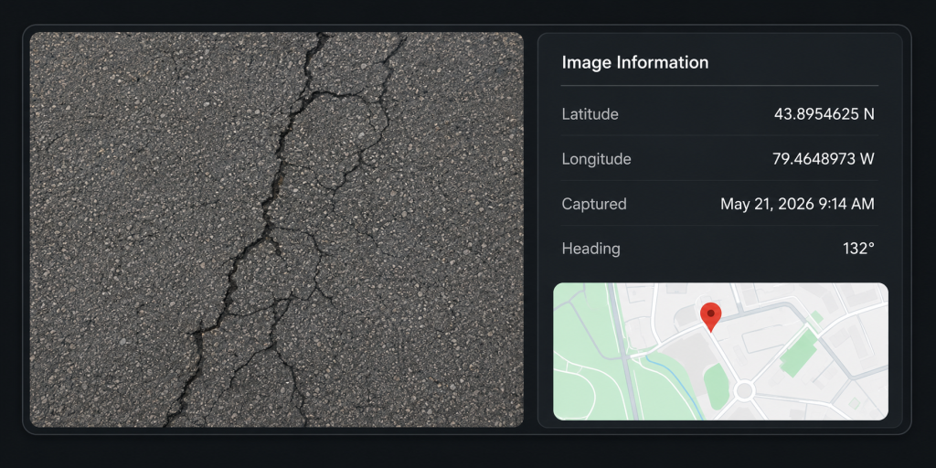
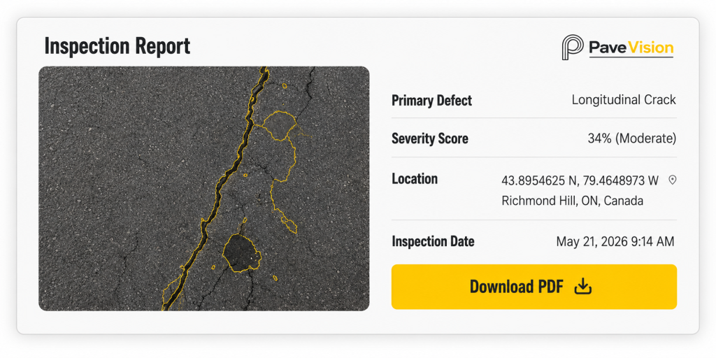
43.8954625 N, 79.4648973 W Richmond Hill, ON, Canada
How Pave Vision Works
A clear path from inspection data to smarter maintenance decisions.
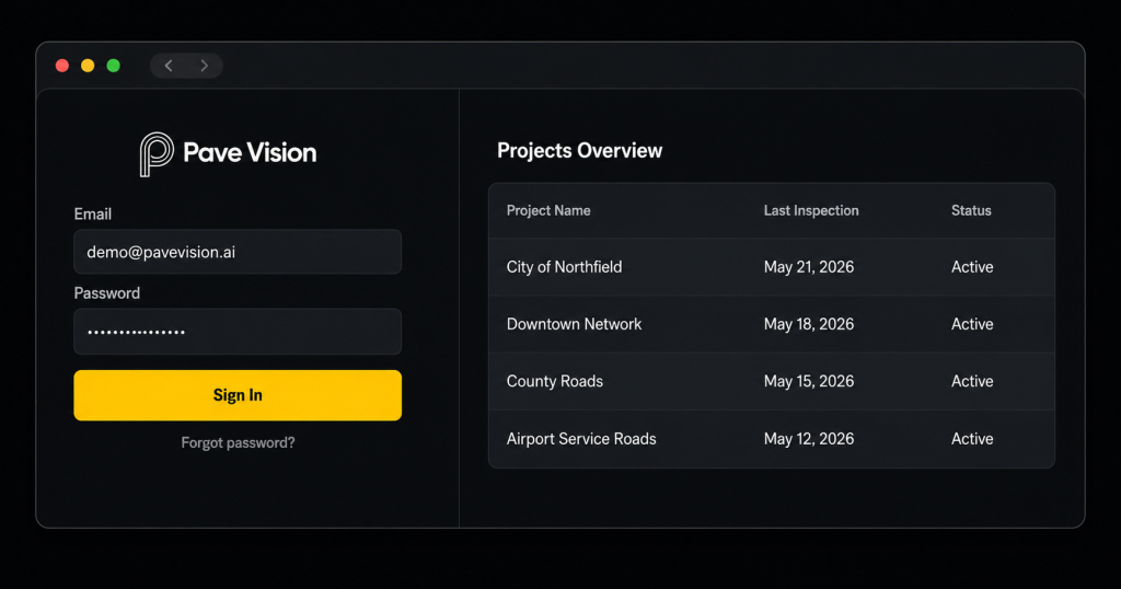
Access the Platform
Sign in securely from any modern web browser.
Provide Inspection Images
Add geotagged pavement images individually, in batches, or through a connected workflow.
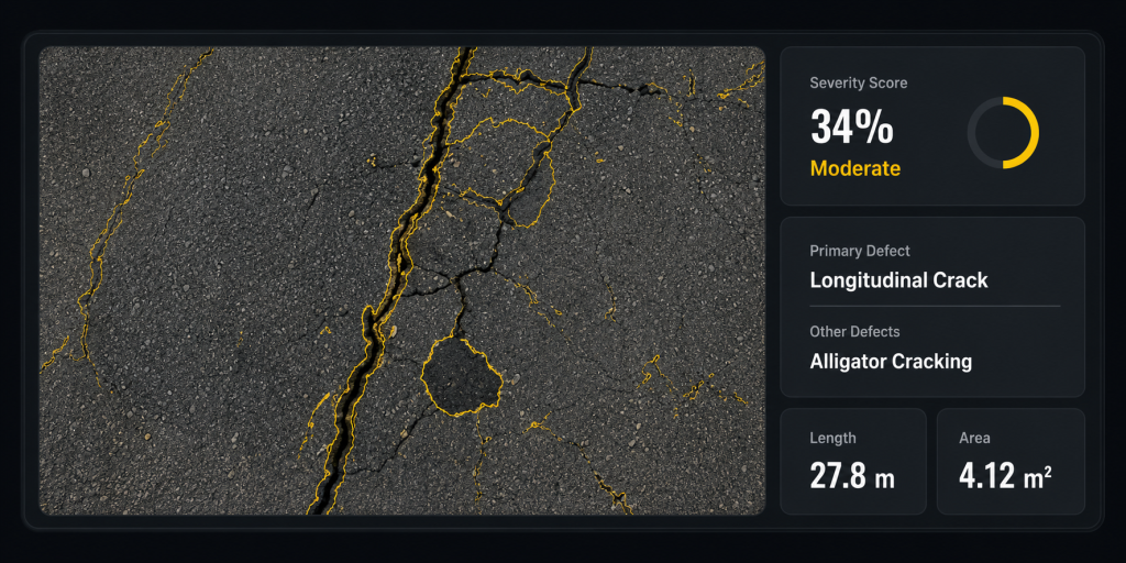
AI Analysis
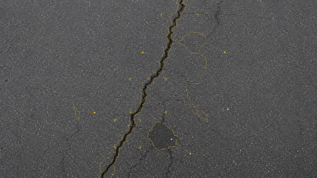
Detect defect types, calculate severity, and associate results with precise locations.
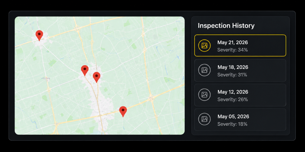
Review and Act
Explore findings, compare inspections, and generate actionable reports.
01
Secure Web Access
Access Pave Vision securely from any modern browser—no software installation required.
Secure sign-in with role-based access
Centralized project dashboard
Works on desktop and laptop
02
Geotagged Image Processing
Provide or connect geotagged pavement images through the secure web platform.
Add images individually or in batches
Automatic GPS location capture
Compatible with connected workflows
03
AI-Powered Damage Analysis
Our AI detects, classifies, and measures pavement defects.
Identifies defect types and affected areas
Calculates damage severity and extent
Delivers consistent, repeatable results
04
Location-Based Results
Review inspection results on maps and track pavement changes over time.
View inspections by location
Compare historical inspection results
Export data and generate reports
See Changes. Make Better Decisions.
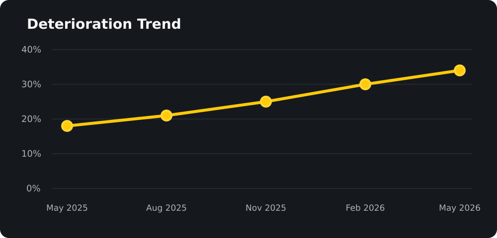
Track deterioration over time at the same location.
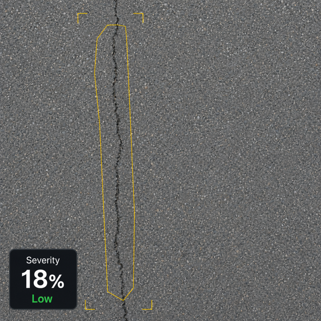
Previous Inspection
May 22, 2025
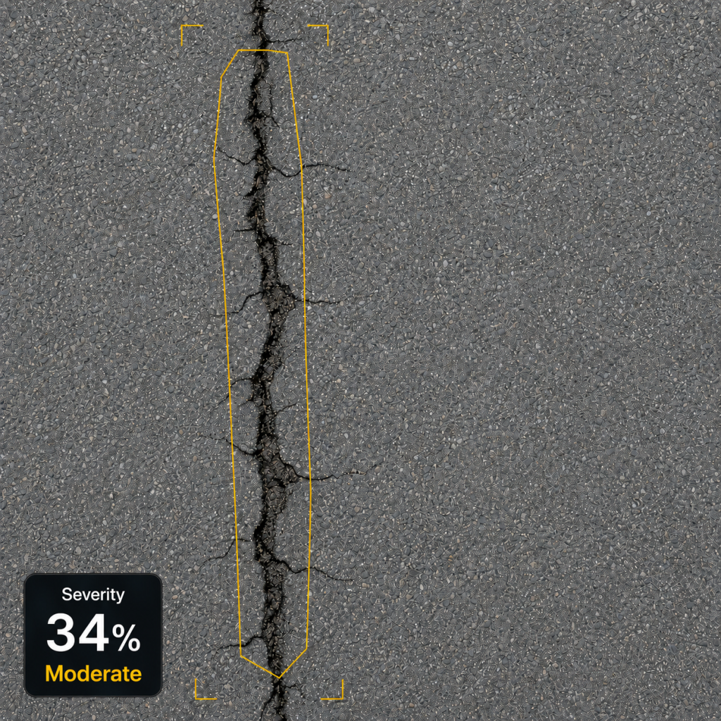
Current Inspection
May 25, 2026
Severity Trend
Recommendation
Condition has declined moderately.
plan maintenance or preventive treatment whithin the next 30-60 days.
Turn Analysis into Clear Reports.
Generate professional reports that summarize pavement conditions, detected defects, locations, severity levels, and recommended actions.
Share with Stakeholders
Export professional PDF reports for teams, clients, and decision-makers.
Prioritize Repairs
Use data-driven insights to identify priorities and plan pavement maintenance.
Maintain Inspection Records
Keep a consistent, location-based history of pavement conditions and inspections.
Built to Fit Real Inspection Workflows.
Flexible today. Extensible tomorrow.
Browser-Based Access
Access Pave Vision securely from any modern web browser—no installation or software updates required.
Batch Processing
Process multiple pavement images together to save time and maintain consistency across inspection projects.
Future API Integration
Designed to connect with external systems and inspection workflows through future API integration.
Your Inspection Data, Protected.
Pave Vision is designed with secure access, controlled user permissions, and reliable cloud storage to help keep your inspection data protected and available.
Secure user authentication
Role-based access control
Protected cloud storage and backups
Ready to See Pavement More Clearly?
Start transforming pavement images into actionable insights today.